San Juan Mountains Millenium Tour
June/July 2000

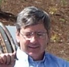
Millenum Jack - Trip Mascot.
INTRODUCTION
This was a great trip through the San Juan Mountains in southwest Colorado during the summer of 2000. My wife, Denise, and I did a bicycle tour starting and ending just outside Durango, CO. Beautiful scenery but quite mountainous.
It was a loop to the north of Durango or more of a figure eight north. We went from Durango west through Mancos (160) to Dolores (184) and then north by Telluride to Placerville (145) and over to Ridgway (62). Then our northern loop took us through Montrose (550) to Delta (50) where we turned east to Hotchkiss and south through Crawford to Sapinero and Blue Mesa Reservoir (92). From there back west by Cimarron to Montrose (50) with a detour up to the Black Canyon of the Gunnison NP. And finally finishing the southern loop going through Ridgway, Ouray and Silverton back to Durango (550).
We have been touring with short wheelbase recumbents for some ten years now. They are much more comfortable than diamond frame bicycles. We're complete coverts and now own no diamond frame road bikes. But even more decadent, in 1999 I incorporated IC (internal combustion) power assist motors to our current recumbents. They use 22cc Honda four stroke string trimmer engines with a friction wheel driving the rear tire. In the spirit of power assist, the drives are geared for 7-9 mph and useful only for hill climbing. They just make those 2-3 mph ugly climbs into 8 mph rides.
This tour is mountainous. Without the power assists it would have been painful and we would not have enjoyed it. But we aren�t strong cyclists. We met several tourists doing quite well on the same routes. Still, even though the scenery was wonderful, I wouldn�t recommend this route for one's first tour.
DURANGO -> DOLORES
June 19th, we left our vehicle outside Durango with friends. After packing the bikes and getting ready to go it started to rain and hail so we sat in the car for 20-30 until it passed, no reason to start in that. Once the thunderstorm passed it was partly cloudy and about 85F, a nice day. We stocked up on this and that in Durango and started towards Mancos but stopped a few miles outside Durango at a private campground. Trying to work into touring mode with a short day. In camp we bought a six pack of 3point2 Miller Genuine Draft to finish the day.
There is quite a hill between Durango and Mancos. We climbed around 1500' mostly using assist, wonderful. There was a lot of construction but we were able to ride on finished shoulders away from traffic. No pass noted on the map or the road which makes you think the marked passes must be worse. This section had a lot of traffic but a good shoulder where there was no construction. We had a good downhill to Mancos.
In Mancos we found free camping at the city park. Mancos seems to be a strange mix and in transition. It has a couple of art galleries, hippy bakery, and one nice restaurant but also empty storefronts and less classy establishments. After finding free camping we figured we could afford dinner at the up scale restaurant, so we did. Ended up the day watching an organized game of T-ball (baseball for very small kids). We bought gas in Mancos, 17 cents.
The road to Dolores (Highway 184) was a good ride. There was new chip seal out of Mancos but after a few miles we found better road with a good shoulder and little traffic. It was a gradual climb up to Summit Reservoir then a gradual downhill to Dolores. Riding along I saw a camel and tried to point it out to Denise but she didn't believe me, well until she looked and saw it. We stopped at the Anasazi Heritage Center outside Dolores, a good museum worth the stop. It turned into a hot day.
Dolores was similar to Mancos being a strange mix and in transition. Some local stores and a good market but a number of tourist oriented establishments. These are probably the boomtowns of the next ten years, exodus and tourism from Denver and...? We stayed at a private campground just outside Dolores. It was another good day of touring.
DOLORES -> TELURIDE
A late start, getting away from Dolores around 10:30. It was already hot but cumulous clouds started popping soon which cooled things off. This was typical of the whole trip; it would get hot early then cloud up with cues and threaten rain. The rain would usually not happen, usually. Although it would normally be wet and/or rainy going over the passes and be way too hot at lower elevations, below six or seven thousand feet.
The road from Dolores was very nice having not much traffic with a good shoulder. You know, a nice low traffic major highway. Not a country lane, but still nice for biking. We had a gradual climb along the Dolores River. Nice country but a steep valley so no vistas.
The sky became darker and it started to rain. We were just getting wet when we pulled into Priest Gulch campground. The rain didn't last long, just long enough for us to rent a cabin rather than a campsite. This was good; counting the week or so driving from Oregon it had been a long time since we had a roof. It was a great little cabin similar to a KOA Camper Kabin but in a lot better setting.
From Priest Gulch it's a gradual climb to Rico. Looked like it could rain but we again escaped. After stopping for coffee in Rico it looked so dark ahead we stayed for lunch. Rico is another town in transition. It had the feel of transiting from old to new, rural to tourism. From Rico it's again a gradual climb until 4 or 5 miles before 10200' Lizard Head Pass. From there it's quite a climb only flattening near the summit. We escaped without getting wet but the roads were drenched for several miles near the summit.
There be mountains here. Beautiful range looking east from Lizard Head Pass and also overlooking Trout Lake just past the summit. These must be the San Juan Mountains. The road north from Lizard Head Pass is precipitous. I hit over 50 mph but there must have been a tail wind as it wasn't that steep. We stopped at the Matterhorn CG a few miles off the summit. It sprinkled a little after setting the tent but no downpour.
It is mostly downhill to Telluride, one climb past Ophir for two or three miles then very steep to the Telluride turnoff. We arrived in Telluride around 11:30 and decided to take the rest of the day off after finding a campground right in town. Telluride isn't in transition; it has arrived as a tourist destination. We found many tourist shops, restaurants, galleries, and a large winter ski area. Their summer calendar showed some type of festival every weekend. The campground wasn't bad but everything else was quite expensive. There are well-restored buildings downtown from the earlier mining era and still others being restored. A nice town to spend a day roaming around in, but for us not much longer than a day. :-)
TELLURIDE -> MONTROSE
We stocked up on food and filled both nearly empty gas tanks for 34 cents before heading out of Telluride on Sunday, June 25. Good roads to Placerville but more traffic, possibly due to it being Sunday. It's mostly downhill to Placerville, a very nice run. I found a large bulge on my rear tire and was forced to change it. There is one convenience store in Placerville but it was closed this Sunday. Not much of a town and little indication it is changing. So don't count on Placerville for supplies.
The climb over the 9000' Dallas Divide was gradual but for about 2 miles. It started to sprinkle/rain as we topped the pass so we didn't pause. Contrary to the rules of touring we did outrun this rainstorm, due only to the steep decent into Ridgway which was four or five miles at 40-45 mph. It must be a harder climb from that side. The mountains to the east were beautiful but would have been prettier if the sun were out.
We ate fries at the famous True Grit Saloon in Ridgway. Not much in Ridgway. It seemed like a staging area or overflow for the tourist destinations further into the mountains but not a supply point like the larger Montrose.
It still looked like rain so we tried to stay at the Super 8 Motel but they wanted $80, Absurd. So we headed north and downhill to Ridgway State Park. Surprisingly we didn't get wet; it sprinkled a little after setting the tent and during dinner but not bad. So far we're sneaking between these storms. Ridgway SP is very nice and the walk in site we had gave a great view to the south. This looked out towards Ouray and the mountains we'll eventually go through. We stayed at Ridgway for a true rest day to wash clothes and plan. The next weekend was fourth of July and we were worried about campgrounds being full. I called some campgrounds in Ouray and finding they were full over the fourth we decided on a loop to the north and to just wing it. Thinking about getting through the fourth was giving us headaches.
The run to Montrose was a gradual decent, just right for cruising. There was heavy traffic though and the first several miles had little or no shoulder. However it widened to have a lane wide shoulder into town. We could see black sky and a storm to the northwest moving our way for a long time. It hit us only a few miles from town getting us quite wet but didn't have enough time to soak us through. We stopped at the first cafe in Montrose for a bad lunch and were able to dry out some. At the BLM/NF/NPS Center we bought a map and asked about camping. Then to the local bike shop where we found a reasonable 20 inch tire after explaining to the owner what a BMX size tire was. He wasn't very friendly but offered that the highway to Hotchkiss was bad for biking. After that comment we then had to badger him into showing us on a map the back roads to Delta and on to Hotchkiss. After buying a tire from him, requesting this service no matter how put out he seemed, bothered me not at all. I should note it's so unusual anyone is less than helpful when we're touring that such an occurrence stands out in our memory. Montrose is a larger town with more than tourism and a good place to stock up on supplies. The sports shop was well stocked with camping gear and had an abundance of fly fishing stuff. It must be a good area for camping and fly fishing. We stayed the night at an ex-KOA in a Camper Kabin, what decadent luxury.
MONTROSE -> CRAWFORD
It was a beautiful day when we got up, warm and sunny. There's a large agricultural valley from south of Montrose to beyond Delta. This leads to a good number of local roads so the highway can be avoided. We followed rural county roads to Olathe, a small farming town, where we ate lunch in the park. From there we followed the rural state highway 348 into Delta. We made one stop along the way at Pea Green, a very small town composed of one store, for cold drinks. It was too hot this day. Delta is the lowest point on the trip at around 4000'. We lost about 1000' on the day but a great way to lose altitude, just enough slope for an easy cruise. Partly sunny all day but for one thunderstorm which just missed us. All in all it was a good day of riding on great rural roads even if a little too hot.
Denise was not feeling well or doing well with the heat. She started taking drugs for Giardia, which she's had before and thinks this feels like. It took two or three days until she felt better but the ailment did responded to treatment for Giardia, so we declared it to be such.
We spent very little time in Delta. All I remember is a large intersection with a good-sized market and modern gas station. After stocking up at these we found a camp just outside town. This camp was a mix of travelers, long term seasonal travelers, long term seasonal residents and permanent year round residents. Not well kept but there were hot showers and a pool. We cooled off "bobing" around the pool before turning in.
Our route from Delta to Hotchkiss was quite a ride. The bike shop guy in Montrose gave us a good route to Delta so we followed his route out of Delta to avoid the highway. This one took us some six miles up highway 65 and then east over some winding up and down nasty hilly roads, over draws and mesas and generally not in any straight line. It ended with a 1000' drop to highway 92 about 3 miles from Hotchkiss. Those last miles into Hotchkiss weren't bad so I suspect highway 92 isn't as bad as advertised. The route gave quite a view of Colorado desert though. At the lower elevations, below about 7000', and away from the rivers and irrigation this portion of Colorado is desert. We had a big Mexican lunch in Hotchkiss complete with what must have been a couple of pitchers of ice tea. After stocking up on several days worth of food we were off to Crawford.
Highway 92 south from Hotchkiss doesn't have much of a shoulder but the traffic was light. It was still way too hot and a climb. The assist motors got a workout over this section. There is a famous stop in Crawford where we had ice cream. I think it is famous only because Joe Cocker owns it but the ice cream was good. A few miles past the town of Crawford we stopped at Crawford State Park to camp. This camp is on a reservoir with no shade but for the man made roofs over the picnic tables, this country is desert. There was no good place to go swimming but there were good showers. Here a hummingbird took great interest in Denise's flower print shirt while it was drying. He also was quite interested in Jack (our mascot, Jack in the Box Millenium Jack) and I'm sure he poked Jack in the eye a couple of times. Life's tough being a mascot on tour. He'd already lost all his party tassles on one of the previous screaming descents.
CRAWFORD -> BLUE MESA RESERVOIR
After the heat yesterday we decided to get an early start. It was clear and already warm at 7:00 so we got on the road about 8:30, early for us. The ride was nice going south on 92. It climbs with a mix of gradual and steep sections slowly rising in altitude. Eventually the road comes out to and follows the upper sections of the Black Canyon where Morrow Point Reservoir is. The elevation peaks out around 8900' in some nice country. Some of the views into the canyon are spectacular. It would be an adventure to take a boat and explore this reservoir. The road goes up and down and then truly down to the dam at Blue Mesa Reservoir and Lake Fork CG where we stayed. After gaining altitude to be in nice forested areas along this route we lost enough to be back in the desert.
It clouded after lunch and looked like rain by the time we were setting up camp. There is little shade or protection at Lake Fork CG. It was nice to have cooler weather but the wind and threatening skies in camp weren't welcome signs. It was windy and a little chilly in the evening, just like the desert should be. No hot showers here but there are places to go swimming in the reservoir.
We decided to stay over and just rest for a day and spent Saturday the 1st mostly sitting and resting. We had a great pancake breakfast courtesy of prepackaged mix, just add water. Then to our joy we found the marina sold ice and soft drinks. With this news we unpacked a dry bag and filled it with two bags of ice and two six packs of soft drinks. We took this up near the bathrooms, where the only shade trees in sight were, and spent the day reading and napping. It was a darn good day. Sun and wind all day but not as windy as the previous evening.
BLUE MESA RESERVOIR -> MONTROSE
Looking for a hot day we bought a bag of ice for out camel backs and started early. The road from Blue Mesa Res. doesn't look bad on a map but it is hilly. Really two hills. It climbs from the reservoir ten miles up and ten miles down over what would be called a pass anywhere else. The descent brought us into Pleasant Valley where we bought drinks and gas. I came close to hitting a deer, which jumped out in front of me on the downhill. I haven't had that happen before, it was very exciting. After a few flat miles to reach Cimarron the road climbs again over another "pass" at around 9000'. It was very hot early but clouded up and spit rain at us during this second climb. It's a good run downhill to the junction with highway 347, the turn off to the Black Canyon of the Gunnison National Park.
There's a rest area at the junction where we ate lunch before starting up to the Park. The road to the Park is a heck of a climb. Some traffic and little shoulder but the traffic is moving slowly and it wasn't bad. The climb though was consistently steep. I don't think we'd have continued this without the power assists. On the day we climbed about 4300' with no named passes.
There was a campground inside the Park where we stayed. During the afternoon in camp it was too hot with only bushes for shade. We ended up sharing our site with another bike tourist, Kevin, who was traveling form Texas to California. He was fascinated with our bikes, organization and some of our gear.
We spent Monday morning the third touring the Black Canyon of the Gunnison NP. Once on top of the mesa the road wanders up and down along the canyon rim. We walked out to several of the overlooks and the canyon is beautiful. It's much narrower than the Grand Canyon with many shear rock cliffs. Kevin met up with us and we all ate lunch at the snack bar inside the Park then rode together into Montrose. The ride from the Park entrance back to highway 50 was a steep downhill but there was a strong headwind. Also the run on highway 50 to Montrose was a nice downhill which was ruined by the headwind. It was enough slope to coast all the way but not on this day, bummer.
We again stayed at the ex-KOA in Montrose but not in a Kabin. Kevin went on to Ridgway being younger and stronger than we. After "bobing" in he pool and washing clothes we went to the Red Barn for dinner. It was a red meat kinda place but we both pigged out on the all you can eat salad bar.
MONTROSE -> OURAY
The Fourth of July found us riding from Montrose back to Ridgway. We gassed up in Montrose, both tanks and spare Sig bottle, for $0.65. These RVs eat a lot. :-)
It was sunny all day but windy. Mostly side wind so it could have been a lot worse, however it did cool things off. As we expected it was a steady gradual climb all day. The four or five miles of no shoulder weren't too bad, even on the Fourth; maybe we were just expecting it or most of the traffic was going the other direction. Along the way we were suckered into a restaurant by the "open" sign but they weren't. So we had a picnic on their porch anyway.
We stayed again at Dutch Charlie CG just south of Ridgway at the walk in sites very close to our site of a week ago. It was quite windy but clear.
The ride to Ouray was very pleasant. From Ridgway State Park we found a bike path to the town of Ridgway. This mostly went along the river and was much more scenic than the highway, a good detour. The True Grit Saloon wasn't open until 11:00 so we ended up having lunch at Subway. Riding to Ouray we could see mountains ahead up the valley for awhile and then were traveling along the bottom of a canyon. It was a nice gradual climb all the way to Ouray.
We found a campsite in Ouray and paid for two nights. Ouray is a nice resort town in a small valley at the base of some beautiful mountains. It is an old mining town that has been restored for tourism. Many nice galleries and restaurants but also many trinket shops. The main attractions are the hot spring pools and jeep trails. It seemed to be a major center for commercial and private four wheeler trips.
We ran into Kevin at the pizza place and talked of going to the hot springs but it was $8/day, a little too much for just the evening. So we had a big Mexican dinner and went back to camp. At the campground we met a couple bike touring the San Juan loop in only four days which sounded amazing and crazy to me. This portion is taking us nine days plus rest days. But I do wish I were able to do this loop in four days.
We spent all day Thursday at and in the hot pools. They have a very nice layout with three large pools of differing temperature. We went for lunch and then right back to the pools, the same for dinner. Denise even splurged on a massage. All in all it was a great rest day.
OURAY -> DURANGO
It was mostly cloudy this Friday, July 7th. We had instant mix pancakes again and out of camp around 9:00. Stopped at the market for ice and found a 10 lb bag instead of the 6 lb bags we'd become used to this trip. We couldn't use it all but did fill up our camel backs and all our water bottles.
The Million Dollar Highway climbs right from the city limits of Ouray and you can even see the switchbacks from town. After this initial climb the road follows a canyon before going through a long alpine valley. From there it's a steep climb to Red Mountain Pass at 11,000'. Overall the climb is steep but varies from maybe 5% to 7% or so. We used assists for all but a few miles of the 13-mile climb. It was a very nice ride. It sprinkled a couple of times but worried us more than got us wet. The ride down to Silverton was thrilling, a nice long descent.
The mountains were very scenic but not increadable. We probably expected too much or maybe the clouds? There has been a lot of mining in these mountains and traces can be seen everywhere. There is at least one major environmental cleanup going on.
Upon arriving in Silverton we looked around a little and then went a mile or so out highway 110 looking for a campground. We found the camp we were looking for but it didn't look good, rundown & swampy with no good shade. We finally went back to Silverton and found a site in a Motel/CG just off the road we'd initially come in on.
It rained after we set camp but let up later in the day. We went into town around 5:00 to look around but found nearly all the shops closed for the day and the town deserted. It turns out nearly all the tourism to Silverton comes up from Durango on the restored narrow gage steam engine. The first train arrives around 10:00 and the last one leaves at 4:00. So the town is nearly empty except between 10 AM and 4 PM. We did have a good dinner at the Brown Bear Cafe though.
Silverton is an old mining town and most of the buildings have been restored for tourism. It does seem completely dependent on the narrow gage railroad from Durango as I said. A lot of shops but we didn't have a chance to look through many of them. It has little in the way of markets or stores with everyday supplies. Saturday morning we ate breakfast at the local gourmet coffeehouse, cinnamon rolls and good coffee.
The ride from Silverton to Durango goes over two major passes, Molas Divide and Coal Bank Pass. The narrow gage railroad follows the Animas River all the way from Durango to Silverton and I sure wish they'd put in a bike path along there. The seven-mile climb to 10,900' Molas summit starts right outside Silverton. Leaving Silverton we saw a whole line of 356 Porsches, there must have been thirty or forty of them. Must be a rally in Durango. From Molas it's a screaming three-mile descent and then back up four miles to Coal Bank Pass. It sprinkled on us a little near Molas Divide but again didn't get us wet. I'm sure it rained there later in the day. The six-mile descent from Coal Bank is a scream. The roads of the Million Dollar Highway from Ouray to Durango are good. Not too much shoulder at times but the traffic isn't extremely heavy and it is moving slowly. It is curvy and quite mountainous. The climbs are of varying grade with a few steep pitches. I think Lizard Head Pass has the steepest climb though.
We stopped at the Forest Service campground of Purgatory for the night. It rained after we set up camp. We cooked dinner late and it was dark when we finished cleaning up. It rained off and on through the night.
Sunday the 9th was clear when we got up but turned partly cloudy. We were on the road about 10:00 after drying the tent pretty well. Great downhill run towards Durango, at least 20 of the 25 miles were a coast. The other five were into a headwind though. After lunch in Durango we climbed the 10 miles or so back to the car.
SUMMARY
Overall a very good trip even if quite hilly. For us the power assists made it fun rather than drudgery. Over the course of the trip we spent a total of $2.48 on gas for the motors. I think we'd normally use the assists around 5-10% of the time but in these mountains it was closer to 15-20%.
The weather was hot, even too hot unless it was threatening to rain. For me this isn't conducive to a relaxing trip, I'm either too hot or worried about being drenched. But for the way the sky looked most of the time we had very little rain. I need to remember one main purpose of travel is to see new things and these weather patterns are included.
The scenery was beautiful particularly the Telluride and Ouray valleys and the vistas from the mountain passes. The whole area is tourist oriented, particularly Telluride, Ouray and Silverton. The downside of this is a lot of tourists but the upsides include nice facilities and stores in most every town and good restaurants whenever you want to go out.
We stayed most nights in private campgrounds and a few national forest campgrounds. Eating out when we wanted to we ended up spending $49/day. That's right at our average but we usually have a few motel nights intermixed.